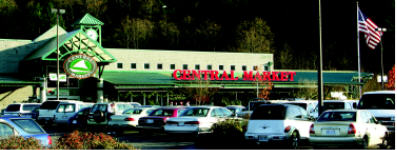
Central Market Weather
Current conditions in Poulsbo, WA
Updated: 3:19am on 7/1/26
|
|
Central Market Weather Current conditions in Poulsbo, WA Updated: 3:19am on 7/1/26 |
|
|
Temperature |
Rainfall | Wind |
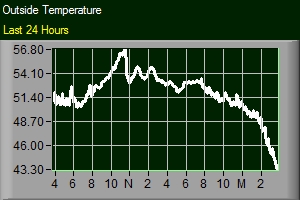
| Current Temp: 55.2° ...feels like 55.2 ° | Today's Rainfall: 0.00 in | Current Wind: 0 mph |
| Yesterday @ 3:19am: 52.9 | Hourly Rainfall: 0.00 in | Current Gust: 0 mph |
| Today's High: 55.7° @ 1:41am | Monthly Rainfall: 0.00 in | Current Direction: SSW |
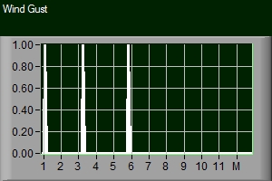
| Yesterday's High: 62.3 @ 5:27pm | Annual Rainfall: 14.39 in | Today's High Gust: 0mph @ 12:00am |
| Today's Low: 54.4° @ 12:52am | Last 24 Hours Rainfall: 0.00 in | Yesterday's High Wind: 0mph @ 12:00am |
| Yesterday's Low: 51.0 @ 1:56am | Yesterday's Rainfall: | Beaufort Scale*: (Click For Details) |
| Days Without Rainfall: |
| Barometer | Humidity / Dew Point | Weather Warnings |
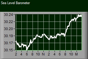
| Current Reading: 30.03 in/ (Steady) | Current Humidity: 85% |
|
| Hourly Rate: -0.002 | Today's High: 87% @ 12:35am | |
| Today's High: 30.03 @ 1:39am | Today's Low: 84% @ 1:48am | |
| Today's Low: 30.03 @ 12:03am | ||
| This Year Low: 29.30 on 1/3/26 | Current Dew Point: 50.8° | |
| This Year High: 30.56 on 3/26/26 | Today's High: 51.3° @ 1:41am | |
| Today's Low: 50.4° @ 12:07am | ||
| PNW Radar |
|
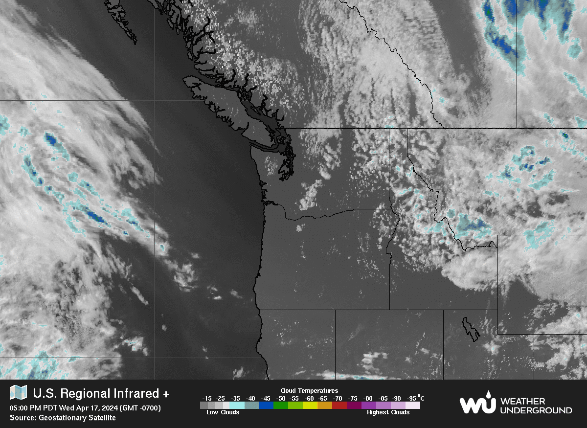
PNW Satellite |
|
|
|
|
|
|
|
| Central Market Links | 7 Day NWS Forecast |
| Central Market Weather Home Page | |
| Mobile Device Page For SmartPhones | |
| Town & Country Website | |
| Town & Country Specials | |
| University Of Washington | |
| Cliff Mass Weather Blog | |
| UW Probability Forecast For Poulsbo | |
| U of W Weather Radar | |
|
National Weather Service |
|
| National Weather Service Western WA Forecast | |
| NWS Discussion - Seattle | |
| National Weather Service Marine Forecast | |
| National Weather Service Warnings | |
|
Mountain Pass Conditions |
|
| Stevens Pass | |
| Snoqualmie Pass | |
| Weather Along I-90 | |
|
Miscellaneous Links |
|
| NOAA Buoy Data | |
| Poulsbo Pollen Count | |
| Puget Sound Air Quality | |
| State Ferry Weather | |
| Space Weather | |
| Edmonds/Kingston Ferry Schedule | |
| Bainbridge/Seattle Ferry Schedule | |
| Kitsap County Webcams | |
| Historical Data | |
| Weather History From This Station | |
| Sunrise / Sunset / Lunar Phase / Tides | |
| Sunrise: 5:17am | |
| Sunset: 9:13pm | |
| Moon Percent: 98% | |
| Moon Rise: 10:43pm | |
| Moon Set: 6:35am | |
| Poulsbo, Liberty Bay Tides - NOAA |
|
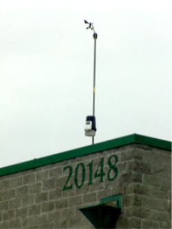
About This Station |
||
|
Thank you for visiting our Central Market weather site.
Our intention is to accurately provide
Accuracy and reliability are very important to us. |
We enjoy hearing from our customers, Contact Central Market Weather
While we have chosen a system that we feel is very accurate, it is important that we also provide the following disclaimer: This station is for entertainment purposes only and should not be used in decisions related to risk of life or property. |
|